
The geographic distribution of Muslims in England and Wales
2021 Census data
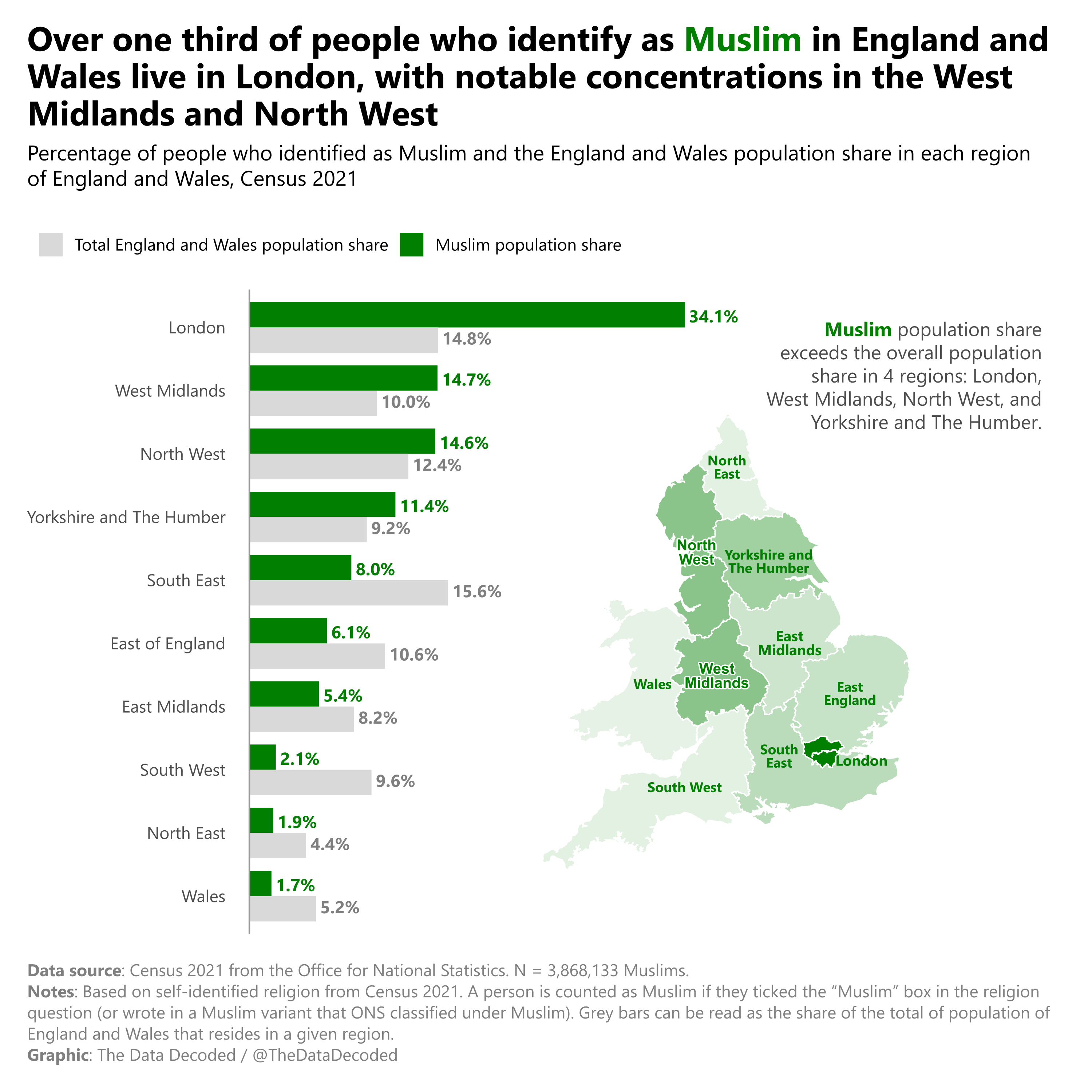
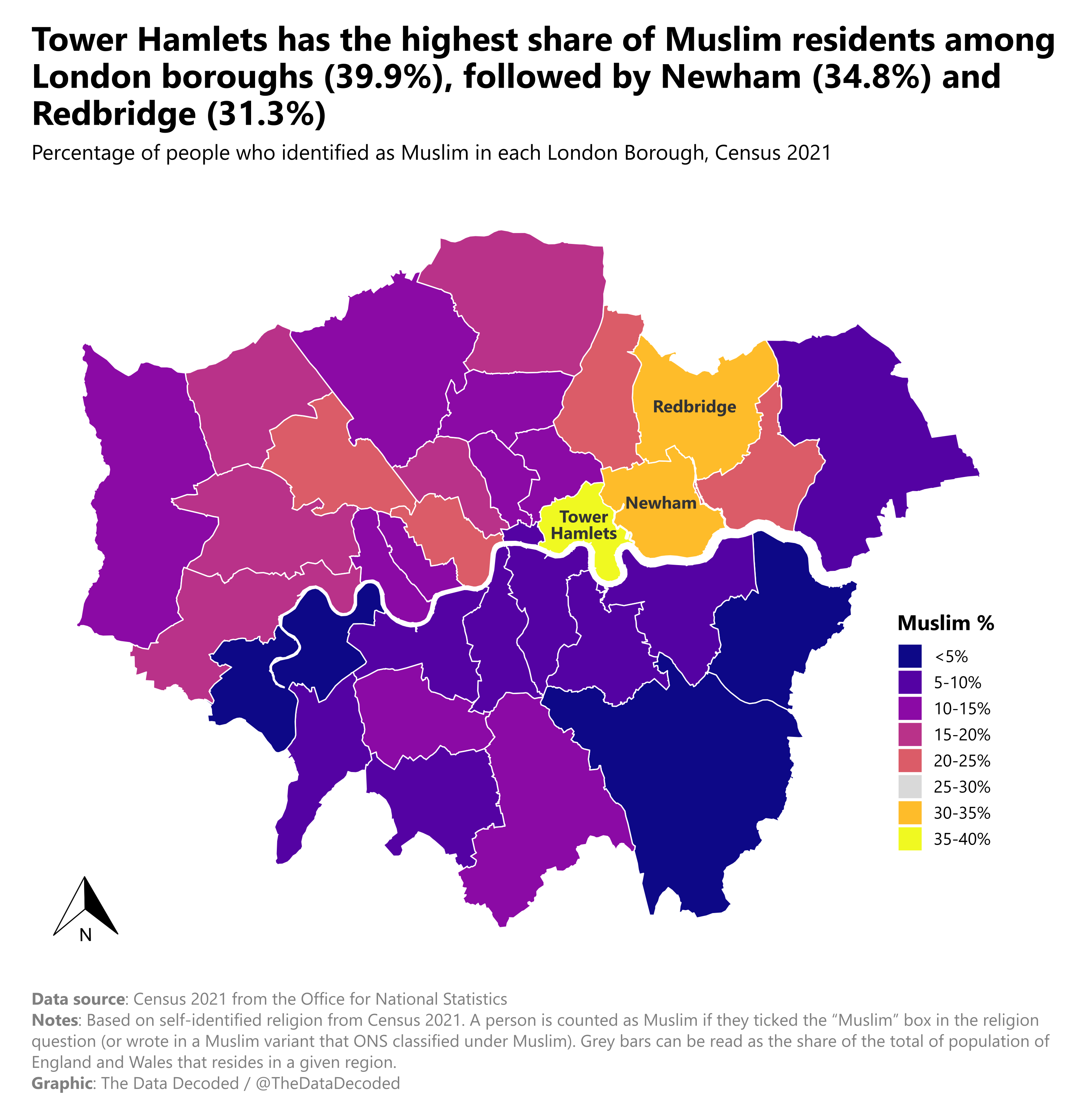
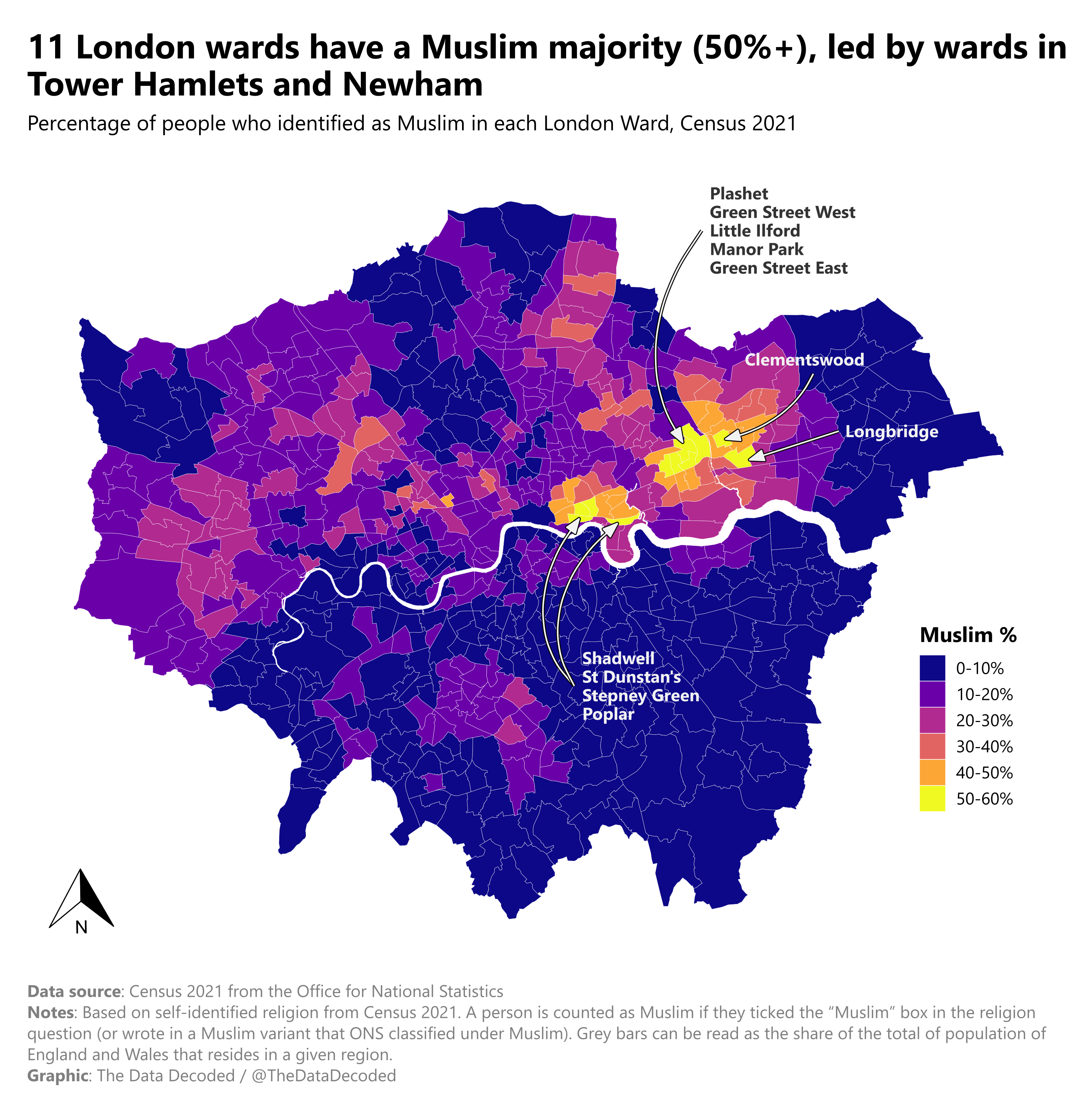
The first chart compares where people identifying as Muslim live across England and Wales with each region's share of the overall population. The maps provide a closer view by London borough and ward.
Sources and methodology
The source is the 2021 Census from the Office for National Statistics. As the original chart explains, Muslim identity here comes from the Census religion question, including written responses classified by ONS as Muslim. The original Quarto analysis processes regional, borough, and ward data for the three figures.